- Who We Are
- How We Work
- Regional / Country Initiatives
- Legacy
- Core Themes
- Working Groups
- Portfolio & Results
- Newsroom
- Resources
Drones for Land Clarification and the Empowerment of Women

Secure Tenure in African Cities - Home
Project selected under the Innovation Programme Call for Proposals 2019:
Secure Tenure in African Cities: Micro Funds for Community Innovation
Project Overview
|
What is the problem? Without formalized land and property rights, poor rural communities in the outskirts of Kinshasa, capital of the Democratic Republic of Congo (DRC), face risks of tenure insecurity, conflict, and land grabbing as the megacity of nearly 15 million people expands.
Where does it occur? Kasangulu, a small city 35 km from Kinshasa, DRC
Who does it affect? Primarily poor farmers in vulnerable communities
What are the causes? The absence of land data needed to produce official title documents, combined with outdated land management tools and the lack of spaces for dialogue between local land stakeholders – especially between the land authority and the communities – are aggravating the constant threat of land grabbing and land conflicts for poor farmers who lack formal land titles for their properties. This further weakens the situation for women, often with large families, who are the main breadwinners. |
Approach The project introduces these major innovations:
|
Achievements
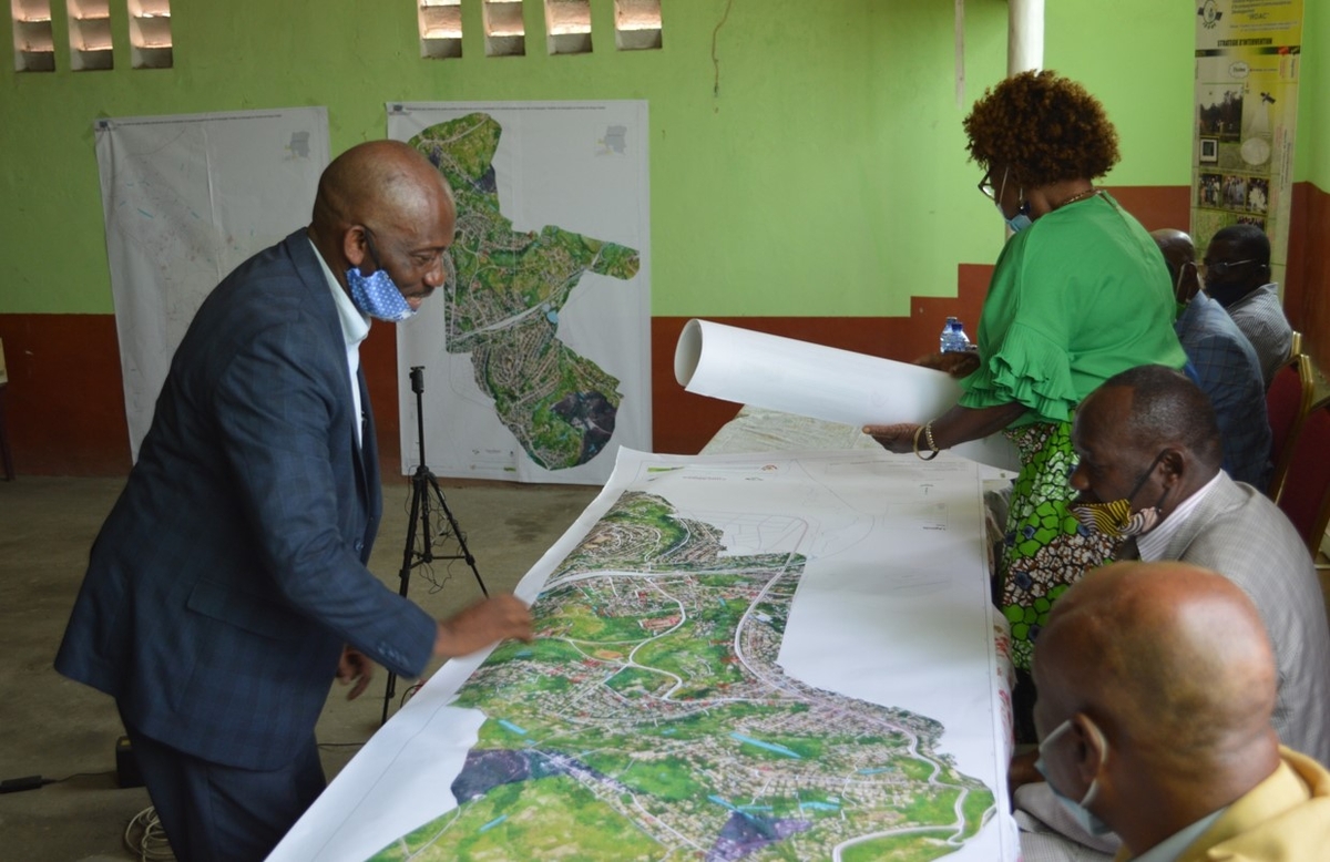
- Creation of a complete land registry plan of four target districts (Ngambi, Luzamba, Manoka and Mvula Nene), covering 622,000 ha.
- Extraction of 4,824 plots from the drone’s aerial (orthomosaic) images: 3,883 in the target districts and 941 in neighbouring districts.
- Measurement and demarcation of a 98-plot sample of RADEKAS members’ land on the land registry plan.
- Implementation of the customized app, Irdac CAD_CollectApp, a smart filter that extracts individual, personalized land data from the land registry database that can then be provided to land registry services for use in allocating official land titles.
- Training on data collection using drones and topographical surveys for 8 young men and 6 women from RADEKAS households, 5 Kasangulu district land registry agents, a Congolese National Police officer, 9 IRDAC trainees and 2 coordinators.
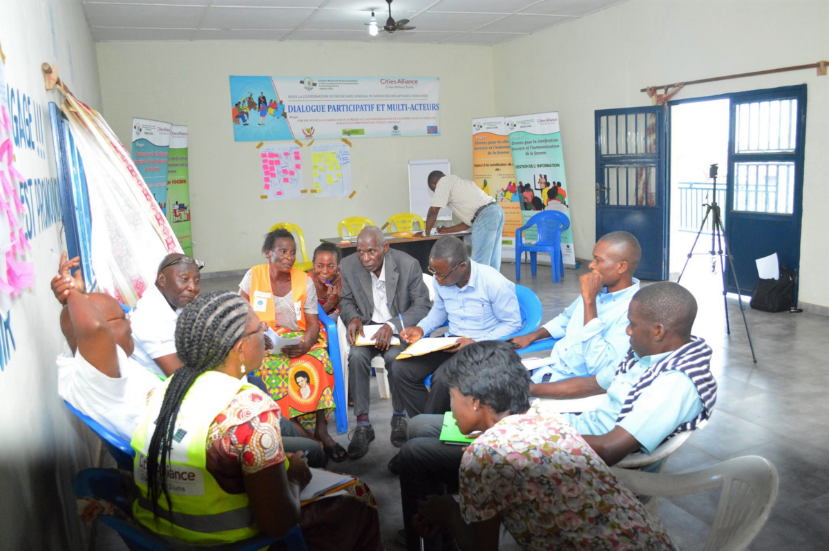
- Establishment of a space for participatory multi-stakeholder dialogue to occur.
- Sharing women’s stories about the impacts of the COVID-19 crisis on precarious household livelihoods to raise awareness on the need to empower women through facilitating secure land tenure, enabling access to microcredit and building resiliency.
- Presentation of project results during a provincial closing session in Kasangulu and during meetings with property and land authorities, the national police, National Commission for Land Reform, Ministry of Housing and Town Planning, and Ministry of Land Management, Agriculture, Fishing and Farming. The project received positive feedback from the Secretary-General for Land Affairs.
Lessons learned
The IRDAC SARL Kasangulu pilot project demonstrates that combining the tools of participatory dialogue between land tenure stakeholders with the use of innovative digital technologies can facilitate the process of securing informal land rights.
The digitization of the land registry is a first step for helping residents to secure their property and informal land rights and for preventing possible conflicts.
Building capacity in land administration and modernizing services are also crucial for helping people secure property rights. Land registry services are essential for documenting claims, archiving records, and granting titles needed to secure land rights for vulnerable communities and to help reduce the issue of land grabbing.
A secure land title alone is not enough to tackle poverty. Empowering women, as the main breadwinners and defenders of household food security, with additional mechanisms for improving livelihoods is a sustainable strategy for enhancing the value of acquired land ownership for the benefit of the family economy.
Plan to capitalize on experience: Presenting the positive results of the pilot project is not enough. An advocacy, monitoring and evaluation strategy will be needed pending the effective integration of the project’s achievements into national land management instruments.
Testimonies
"The multi-stakeholder dialogue enabled me to meet and exchange views for the very first time with the Registrar of Real Estate Titles (CTI), the No. 1 land service in the Registration Division of Kasangulu."
- Madiampamba, President of the customary chiefs of the Kasangulu territory
“The drones facilitate the real-time collection and rapid updating of land data, compared with traditional methods."
- Boniface Makando Ngu, Director of Land Affairs
About the grant recipient
Initiative Régionale de Documentation & d'Accompagnement Communautaire au Développement (IRDAC Sarl) is a start-up organisation with expertise in participatory mapping and remote sensing in the DRC. Its services include promoting innovative use of civil drone technology to access high-resolution, geo-spatial information to capture and manage land data and other drone solutions services. The organisation also offers training in tele-piloting drones and supports communities in sustainably managing environmental projects. IRDAC SARL is member of Africa Goes Digital (www.AfGoesDigital.org), a large African start-up network which provides drones solutions services around Africa and is supported by CTA (www.cta.int).
Resources from this project

(Report) |

Project Update (December 2019) (Report) |
